
 by Gareth
Platteklip Gorge is the classic way to reach the top of Table Mountain, and it remains one of the most historic and beloved trails in Cape Town. For many hikers, this is the route they choose when they want a direct path to the summit without complicated navigation. It is steep, challenging in sections, and incredibly rewarding from start to finish. With dramatic rock walls guiding you upward, sweeping views that open the higher you climb, and the sense of climbing through a natural corridor carved over millions of years, Platteklip Gorge offers an experience you do not forget. Once the adventure is done, relaxing at Forries with a well-earned drink or meal is the perfect way to celebrate the achievement.
Where Is the Starting Point?
The Platteklip Gorge starting point is located along Tafelberg Road, not far from the Table Mountain Cableway station. The drive from central Cape Town is quick and straightforward, making it one of the most accessible hikes in the city. Those staying in Newlands or Claremont can reach the start in a short time, and it is equally easy for tourists arriving by taxi. Parking is available along the roadside, though it is wise to arrive early before the crowds pick up. From the moment you step onto the path, you are enveloped by the rugged beauty of the mountain and immediately understand why Platteklip Gorge Cape Town is one of the most talked-about trails for both locals and visitors.

Route Overview: What the Trail Is Really Like
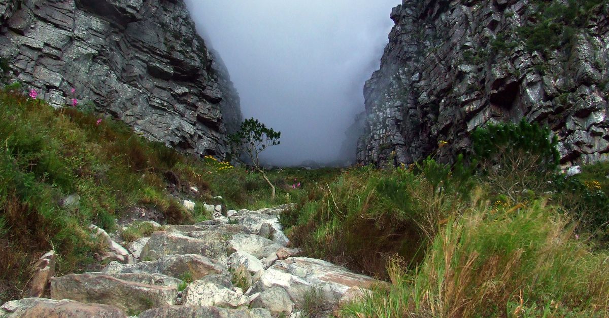
The Platteklip Gorge trail is famous for being direct, steep, and wonderfully scenic. Unlike other routes that wind around the mountain slopes, this trail leads hikers straight upward through the natural ravine, following hundreds of stone steps and rocky switchbacks. The giant rock faces that flank the trail make you feel as if you are climbing between the pages of a geological textbook. Because of its simplicity, many hikers assume it is easy, but the gradient quickly proves otherwise. This is a sustained climb that demands reasonable fitness. As you ascend, the views shift from the city bowl to distant Cape coastlines, and you will find the sense of progress deeply satisfying.
What Is The Distance, Time and Difficulty of The Trail?
The Platteklip Gorge hike distance is roughly two and a half kilometres from start to summit, but do not let that number deceive you. It is a short trail in terms of length, but a tough one in terms of vertical gain. Most hikers take between two and a half to three hours to reach the top, depending on fitness levels and weather conditions. That makes the Platteklip Gorge hike time ideal for those wanting a half-day adventure with a big payoff. In terms of the Platteklip Gorge hike difficulty, expect a steady incline with almost no flat relief, meaning your legs will feel the workout long before you reach the top. But this is part of what gives the route its charm. Whether you are hiking solo, joining a guided group, or tackling it with friends or family, this is a trail that rewards determination.
How to Get to Platteklip Gorge
Reaching Platteklip Gorge is remarkably easy. Whether travelling by car, Uber, tour shuttle, or even the MyCiTi bus system, getting to Tafelberg Road is straightforward. Many hikers like to combine the climb with a cable car descent, especially in summer when temperatures rise quickly. The proximity to the cableway makes this simple. If you prefer a full hiking day, you can walk from the top of Platteklip across the plateau toward Maclear’s Beacon or simply explore the various viewpoints. Table Mountain Platteklip Gorge remains one of the most accessible ways for tourists to experience the mountain without worrying about a complicated way of getting there.

Route Description of Platteklip Gorge
The route begins gently before quickly becoming a consistent uphill journey. The early stages offer breezy city views and a clear path underfoot. As you climb higher into the heart of the ravine, the rugged rock walls close in around you, creating dramatic scenery unique to this part of the mountain. The higher you ascend, the cooler the air becomes, and the final push opens onto the famous upper plateau. For route markings, you can access the official Platteklip Gorge hike map on apps online or from Table Mountain National Park resources. The signage along the trail is clear and easy to follow, adding to the confidence of hikers who want a direct route to the summit without complicated turns.
Safety Tips for Hiking Platteklip Gorge
While Platteklip Gorge is one of the busiest trails on Table Mountain, it is not one to take lightly. Summer heat can be intense, and the ravine can trap warm air, making it important to stay hydrated. In summer, begin early in the morning to avoid the worst of the sun and always carry more water than you think you need. Strong winds are common near the summit, and weather can shift rapidly in Cape Town, so pack layers even on warm days. Let someone know your hiking plan, stick to the path, and turn back if weather conditions deteriorate. The trail is safe when approached responsibly, but like all mountain routes, it demands respect and preparation.

What to Pack for Your Platteklip Gorge Adventure
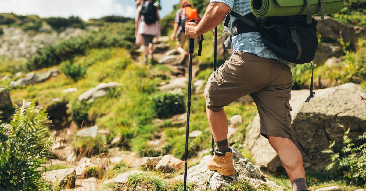
Packing for Platteklip Gorge depends on the season but typically includes plenty of water, a hat, sunscreen, quick snacks, supportive walking shoes, charged cellphone with emergency numbers saved, and layered clothing. During winter, temperatures can be cool and the steps can be damp, so having a warm top helps significantly. Many hikers bring trekking poles for the descent if they choose to walk down instead of taking the cable car. Even though the trail is well-marked, downloading a Platteklip Gorge hike map route map to your phone will give you peace of mind. If you plan to take the cable car down, keep a card or cash on hand, or you can buy the tickets online in advance.

Relax at Forries After Your Hiking Adventure
Once you have completed your Platteklip Gorge hike, there is nothing more satisfying than settling down at Foresters Arms in Newlands for a cold drink or hearty meal. Whether you choose an ice-cold beer, cider, refreshing soft drink, or a well-deserved glass of wine, the leafy setting and warm atmosphere provide a wonderful contrast to the exposed mountain terrain. If you are visiting Cape Town as a tourist, it is an excellent way to pair your outdoor adventure with great local hospitality. Our menu offers comforting classics, generous portions, and options for every appetite, making it the perfect end to a memorable Table Mountain Platteklip Gorge experience.

Final Tips Before Beginning Your Hike
Before setting out, always check the weather forecast and avoid starting late in the day. Conditions at the top of Table Mountain can be very different from the base, so pack appropriately. For those new to hiking or visiting Cape Town for the first time, using a Platteklip Gorge hike map or joining a guide can be a smart choice. The mountain is safe when treated with respect, preparation, and awareness, and Platteklip Gorge remains one of the most rewarding routes for hikers of all levels. After completing the journey, remember that Forries is just a short drive away, ready to welcome you with great food, friendly service, and an atmosphere that celebrates adventure.
